


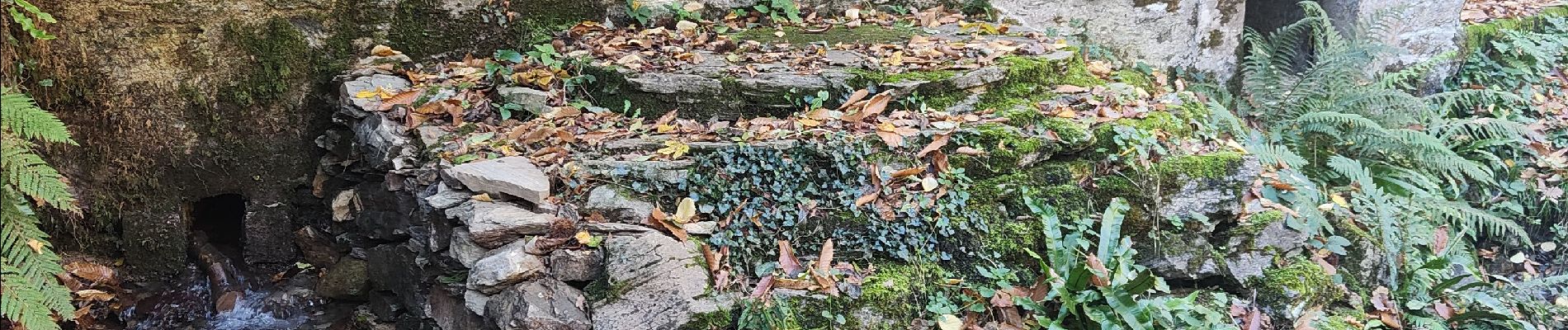
Source de la Cesse Guilaine

Ada11
User GUIDE

Length
14.9 km

Max alt
618 m

Uphill gradient
480 m
Km-Effort
21 km

Min alt
340 m

Downhill gradient
480 m
Boucle
Yes
Creation date :
2023-11-19 08:40:07.145
Updated on :
2023-11-26 14:24:02.965
5h02
Difficulty : Easy

FREE GPS app for hiking
 SityTrail
IGN / Geographical institutes
SityTrail Plus
The world is yours!
About
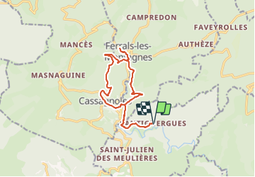
Trail Walking of 14.9 km to be discovered at Occitania, Hérault, La Livinière. This trail is proposed by Ada11.
Photos

Positioning
Country:
France
Region :
Occitania
Department/Province :
Hérault
Municipality :
La Livinière
Location:
Unknown
Start:(Dec)
Start:(UTM)
471164 ; 4802771 (31T) N.
Comments